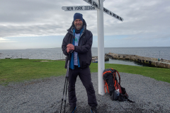
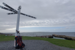
Day 1. John o’Groats to Sinclair’s Bay

John o’ Groats Trail Day 1.
Distance today: 20.7 miles.
Total distance: 20.7 miles.
Accommodation: wild camping.

When planning the trip I’d had great aspirations about doing a daily video blog. I’d even bought a stand for my phone to allow me to go hands-free when doing my piece to camera. Within 5 minutes of starting the trip, I realized it was not going to happen. All those Youtubers made it look so easy. It wasn’t. Finger problems. Pointing the phone in the right direction problems. Coherent speech problems. I think I’ll stick with photos and the occasional written word.

And in other news: the sky was blue. My first day of a long trek, in Scotland, and the gods were with me.

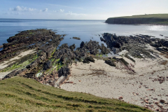
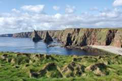
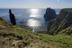
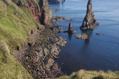
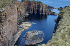
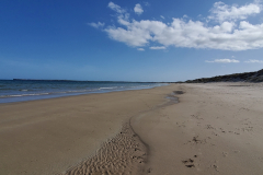
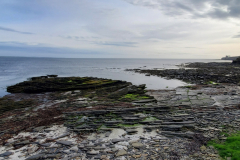
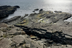
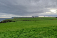
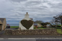
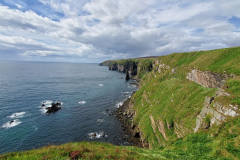
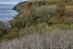
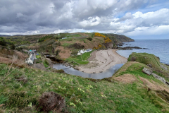
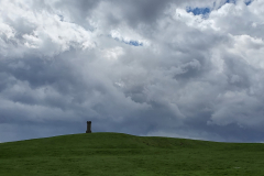
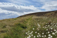
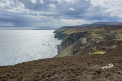
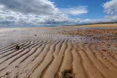
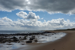
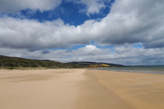
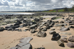
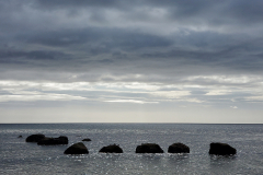
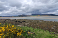
Hopefully you can see from the photos that the some of the scenery was absolutely stunning – the Duncansby Stacks in particular. Not to mention the stretches of beautiful deserted beach.

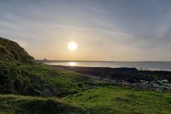
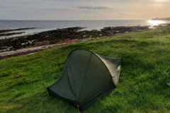
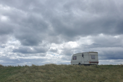
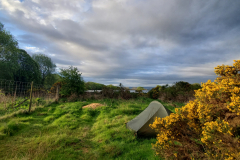
I finally stopped for the day at a place called Akergill Shore. My first wild camp of the trip and nestled on a small plateau of grass just above the rocky shoreline, I couldn’t have asked for a better backdrop. Breathtaking. It’s fair to say I’m not a wild camping devotee (although I did once sleep under a BMX ramp in Monte Carlo – but that’s another story). I love the idea of being in the middle of nowhere with the feeling that there is just you and the landscape. The reality was that I wasn’t far from civilization and as if to prove my point, a man walked past, talking on his mobile phone. Great, now someone knows I am here and they are going to come and steal all my stuff in the middle of the night. Or worse. Ah, the joys of paranoia.

At the risk of angering the hiking purists again, my plan for food was definitely going to be ‘flexible’. If there was a pub or café in the area I had no problems giving them my custom. On the other hand, if amenities were a bit thin the ground, I was quite happy to make use of my stove and whatever dehydrated food I had with me. On tonight’s menu it was mushroom risotto. What can I say? After walking 20 miles, it was the most delicious meal I have ever had in my life. Context is everything.

Day 2. Sinclair’s Bay to Whaligoe

John o’ Groats Trail Day 2.
Distance today: 19.4 miles.
Total distance: 40.1 miles.
Accommodation: wild camping.

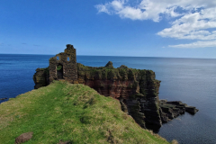
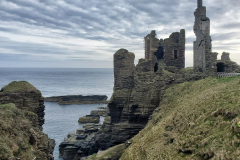
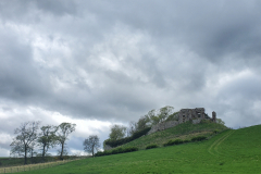
I survived! I even had a reasonable sleep. One distinct advantage of wild camping is having an efficient start to the morning so as to avoid having to explain anything to anyone. I think I was on the trail by about 7. By 8 I had walked around the coast as far as castle Sinclair Girinigoe. I think my phone took a reasonable photo but even that doesn’t really capture the atmosphere and the drama undeniably enhanced by a moody sky and having the place to myself. Very special and just a few pangs of regret that I didn’t have my ‘proper’ camera with me.

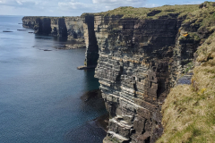
When they say coastal path, they really do mean coastal. On many occasions there was very little between me and a sheer drop down the side of a cliff. Relatively speaking the trail is still quite new and I think further discussions may be required with the landowners to see if they can spare a couple more yards. Indeed, on some occasions not only were there barbed-wire topped fences but just in case you were confused by the suicidal cliff-top paths, there were also signs to remind you that yes, you were meant to walk outside the fence so don’t even think about taking shortcuts inland. Part of me would like to think that it was out of a sense of benevolence that the farmers were simply reminding us that we had chosen a coastal path and we would only be letting ourselves down if we didn’t stick to it. I somehow doubt it. Still, when you weren’t worrying about falling to your death, the views continued to be spectacular. Battalions of sea birds colonized the cliff sides while the air was filled with squawks and the pungent after-effects of thousands of fish dinners.

My mid-morning stopover was in Wick. After a quick scout around town, Wetherspoons seemed to be my best option for re-fueling. Treated myself to a full Scottish breakfast and a bottomless cup of tea while I sat in a corner, recharging my phone, doing some Instagram stuff and generally enjoying having a breather. When the locals started arriving and hitting the beers, the noise levels definitely increased, signalling that it was probably time for me to move on.

Carried on walking along the coast until I eventually reached the Whaligoe Steps. A natural harbour had been made accessible by 300+ steep steps zig-zagging their way down from the cliff tops. Was it worth the effort going to the bottom given I that I was carrying a full pack? Probably not. But I am a completist and so didnt really have much option. There were photo opportunities to be had, I just didn’t find them.

I was pretty knackered by now. 19 miles is a reasonable distance on flat tarmac and I certainly haven’t seen much of that on the trail so far. I ended up camping in a field about a mile further on from the steps. No animals around and there was a stone wall to protect from me the south-westerlies. 5 minutes after pitching the tent, the wind suddenly whipped up from somewhere and when I took a peek outside, I now found myself in a field full of sheep. Where had they been hiding?! Thinking that I was likely to be up to deal with either a collapsed tent or an angry farmer, I just slept in my clothes. I really do need to suss this wild camping thing.

Day 3. Whaligoe to Dunbeath

John o’ Groats Trail Day 3.
Distance today: 18.1 miles.
Total distance: 58.2 miles.
Accommodation: campsite.

The good news was that there were no angry farmers to greet me when I got up. The bad news was that the sun had gone and it looked like I was in for a day of rain.

My next major landmark on the trail was Lybster. While it’s still early days, the section of trail from Whaligoe to Lybster wins the award of being the hardest so far. Wet and miserable with not much to distract me. In terms of footwear I had made the tactical decision (based on various thru-hiker forums) to use boots which didn’t have a waterproof lining. The theory being even Gore-Tex boots were going to get wet so you were better off using something that was more likely to dry quickly. Needless to say, my feet were soaking and I could feel a couple of blisters developing. All in all, I arrived at Lybster feeling a bit low.

I really needed a place to have a coffee and dry out. Speaking to the people in the post office, they weren’t hopeful but then one of them remembered the Lybster Day Care Centre and kindly rang them to check if they were open. Happily, they were. The centre was only a short walk round the corner and there to welcome me were two women who worked there. I shamefully don’t remember their names but I do remember their kindness. They were absolutely lovely. Firstly they brought me a cup of coffee with a selection of biscuits and then a filling bacon bap. As I slowly dried out, we happily chatted, mainly about my trip, the goings on at the day centre and where they both were from. The elder Scottish woman (I am guessing in her late sixties) had worked there a while whereas it was the first day for the younger English woman (late forties maybe). When it came time to leave I asked how much I owed them and they said no, you’re doing it for charity, that’s fine, you don’t have to pay anything. It might not sound like a grand gesture but it just really, really lifted my spirits. People can be so nice. I moved onto the second leg of the day’s journey a happier soul.

With the incentive of a campsite if and when I got that far, Dunbeath was my optimistic goal for the afternoon. Improved spirits, weather, and scenery definitely helped and it was only on the outskirts of Dunbeath where I hit a slight technical hitch. The trail appeared to want to take me through the middle of a field of cows and more significantly a scary looking bull. With no obvious exit out the other end I decided I would forgo my usual pedantic trail-following rules and make a beeline for the road. As luck would have it, the campsite was just a half mile further on.

Let me hereby recommend the lovely Inver Caravan Park. Firstly, as a thru-walker I was charged the princely sum of £7 for my pitch. Secondly, the hot showers were housed in their own private B&B style bathroom. And the cherry on the cake? A drying room where you could put all your damp clothes on a rack, raise it to the roof, and pretty much guarantee it was going to be dry in the morning. Perfect.

Day 4. Dunbeath to Helmsdale

John o’ Groats Trail Day 4.
Distance today: 18.5 miles.
Total distance: 76.7 miles.
Accommodation: hostel.

Without going into too many details, spending a large part of yesterday in swamp conditions had not done my feet any favours. It was like a crime scene down there. Blisters, inevitably, but also some uncomfortable tenderness underneath together with a disturbing amount of angry red around my toes. It wasn’t pretty.

The plan for today was to try to get as far as Helmsdale which, as with yesterday, was a stretch. Someone had recommended a hostel in Helmsdale so that was the incentive. Leaving Dunbeath, the trail was nice and easy for the first couple of miles with a combination of pavements and well-trodden paths. There was even a post office to re-stock on essentials: mars bars and, slightly bizarrely, hot-cross buns. The transition to the more rugged coastline track was marked unceremoniously by me snagging my waterproof trousers on some barbed wire as I was climbing over a stile. I was not impressed. Why would they put barbed wire here?! Luckily it was just a small tear right down at the bottom of the trousers.

Weather-wise it was one of those days where it kept on flipping between sun, rain and wind which meant it felt like I was constantly having to change layers – although better that than have it hammering down the whole time. Of the few walkers I’d met, most had warned me about the number of ups and downs on this section. They weren’t wrong. While the scenery did its best to be distracting there is something disheartening about checking the miles you have walked and discovering it is no where near as many as you hoped or even would have actually done had you been on flat tarmac. Then there are the regular annoyances you get when you lose sight of the waymarkers and you’re in the middle of nowhere with no idea where you’re going. I genuinely started to do my best impression of a native American tracker, studying the ground for boot prints and looking for turned grass to see if somebody had been this way within the last couple of days. It wasn’t desperation but simply the recognition that it was generally a lot easier to follow an established trail than just make your own one up. And the sooner you found it the better. Ultimately, I was following a coastal path which meant it was difficult to go too far wrong if you just headed back to the coast. That’s not to say I wouldn’t have appreciated a few more visible waymarkers.

On the subject of waymarkers, I found myself pondering the theory that when the signs were slightly old and knackered and the stiles were old and knackered (and the walker was old and knackered), then there was a good chance you were in for a really dodgy section, likely to lead you down or by the side of a cliff. But if the signs and stiles were relatively new then generally the route was straightforward. The evidence certainly seemed to support the theory.

Had a brief stop at the picturesque Berriedale to air my feet and pass the time of day with an old English couple who had just moved to the area.

By 5.30 I was still nowhere near Helmsdale and so rang the hostel to check that they were okay with me arriving late. No problem. The track from there took you in and out of lots of little coves which were pretty enough but tiredness was creeping in and they became things I had to get past rather than admire. At some point it definitely looked like you could avoid the hills by walking along the beach. Unfortunately the stones made it hard going. Eventually I rejoined the track near Helmsdale and got to Helmsdale Lodge Hostel just after 7pm. The curse of Covid meant I had to pay £50 for a whole room because they weren’t allowing any shared accommodation. That said Marie the host was both friendly and helpful, suggesting I lay my soaking tent out to dry in one of the big sheds in the garden.

A pint and a chili con carne in the Bannockburn Inn and that was me done.

Day 5. Helmsdale to Brora

John o’ Groats Trail Day 5.
Distance today: 12.9 miles.
Total distance: 89.5 miles.
Accommodation: campsite.

Marie recommended that I skipped the first part of the official route because it only took you up hill and there wasn’t much to look at. I thanked her and then proceeded to completely ignore her advice because of my ever-so-slight OCD tendencies. I had to stick to the official route. Where possible. Or convenient. It was actually a nice gentle start to the day – like a warm-up walk before the proper walk. It ended up taking me along a country lane complete with a few ramshackle houses, and then on through fields and a gathering of cattle begrudgingly moving out of the way of a stile. And there was even a cheery encounter with a little lamb which either thought I was its mother or wanted to be my friend.

Once I reached the coastline is was pretty much long, empty, sandy beach or near beach for the rest of the day. It definitely made a welcome change to the slog of some of the previous sections of the trail. The trick walking on the beach was to find the Goldilocks sand. Not too many stones, soft but not so soft you sink in and waste a lot of energy.

At one point a small river made its way down to the sea and very effectively blocked my path. With no handy bridge to cross it (unless I was prepared to climb up onto the railway bridge) it was off with the boots and socks and clearly taking my life in my own hands, wading tentatively across. In reality, it was a foot deep at the most and made fairly straightforward with the help of my trekking poles. Not that I wanted to do it twice and nor did Bob who had just done it in the opposite direction before I arrived. Bob was a few years older than me and was walking Land’s End to John o’ Groats – in smaller sections, I think. More significantly, he had left his mobile phone on the other side. Once I’d reached dry land I managed to find his phone and then, at his request, threw it to him. Not sure I would have done that with my phone but they were safely reunited and I had done my good deed for the day.

Eventually made it to a place called Dalchalm, on the outskirts of Brora. This was the location of the Brora Club Campsite which was obviously more set up to receive caravans and mobile homes but thankfully still had a strip of grass put aside for tents. £12 for a pitch. Bizarrely, a few yards beyond the fence there were people playing golf on the local 18 hole course. Once I’d set my tent up I went for a wander in the hope that the golf club might have some cheap food. It was probably about a mile or so to get there and disappointingly, beer and crisps was all they could offer. It would have to do.

Day 6. Brora to Embo

John o’ Groats Trail Day 6.
Distance today: 21.4 miles.
Total distance: 110.9 miles.
Accommodation: campsite.

First stop: Linda’s Place which was an old-school café in Brora. I’d been craving scrambled eggs on toast for a while and finally got to have some. Chatted with the woman running the place – possibly Linda herself – and she confirmed they did get a lot of hikers but probably more cyclists who tended to arrive in big groups and take over the place. As if on cue, 3 overweight Scandinavian cyclists came in and pretty much took over the place.

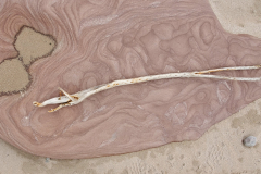
Time for another long beach. While the walking was generally easy, a strong headwind and the occasional stony section probably made it slightly tougher going than yesterday. Not that I was looking for distraction but when I stumbled across a piece of driftwood I convinced myself it looked like the Bath Ales hare logo and spent some time trying to take an arty photo of it. Maybe my subconscious was worrying about where my next beer was going to come from.

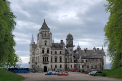
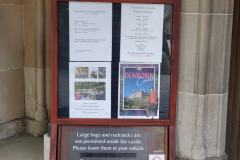
One of the advantages of not doing extensive research is you get to be surprised. As I walked along the coast I could see a big castle in the distance. A very big castle. The closer I got the more impressive it became. In fact I’d say it looked more like a French chateau than a castle but whatever it was, it was very grand. Turned out it was Dunrobin Castle. I took a detour away from the coast and eventually got to the front door. It was open to the public but alas having a rucksack and no car meant I was barred from entry. Travelling vagabonds were not welcome. I don’t think my feelings were hurt too badly. I do have a strange relationship with history and its artefacts in that I am generally interested in what it looks like but not fussed about the detail. Or at least paying to see the detail.

After a pitstop in nearby Golspie (reasonable coffee but shockingly bad sponge cake disguised as a muffin) there was a little bit further to go along the beach before the route turned inland to do a big circuit around Loch Fleet.

Having spent the majority of the trail on barely established paths, it was a novelty to walk on a combination of ‘proper’ tracks and country roads. The loch itself had quite an estuary feel to it, complete with mud flats and sand banks inhabited by an extended family of sunbathing seals. I think the day was definitely catching up with me and I was happy to finally see the signs telling me I had reached Embo. Other than knowing it catered for caravans and tents, I had no idea what to expect from the campsite. Welcome to the Butlins-style Grannie’s Heilan’ Hame. I think it’s fair to say it might be a little bit past its best but obviously not so far as to deter the legions of people in mobile homes or the not so mobile static caravans. For the backpackers, they had put aside a stretch of ground called the dunes. A dune-like hill did separate you from the rest of the campsite and it made you wonder what you were paying for. It definitely wasn’t for a sense of enclosed security. And the showers were rubbish. In the spirit of providing an even-handed review, I did go to their bar and have a very nice half-chicken and chips.

Day 7. Embo to Balnaguisich

John o’ Groats Trail Day 7.
Distance today: 25.9 miles.
Total distance: 136.8 miles.
Accommodation: wild camping.

A reasonably early start although the weather was not looking too promising. I hadn’t gone far down the road when I bumped into a fellow walker who had started his trip in Inverness. He looked the part with a compass strapped to his rucksack and a big transparent map holder hung round his neck. We had a bit of a chat and he reckoned I should be able to get to Inverness in 2 days. I was a bit skeptical but then I thought well, if he can do it …. Mind you, he was cheating by relying on B&Bs rather than carrying his own camping gear. Just as I was cheating by not wild camping all the time.

Next stop Dornoch. The town looked like it had a bit of money about it, not least with the fancy golf course and all the surrounding houses. I was genuinely taken aback to see a golfer with his own caddy in tow. I seriously thought that just happened in major competitions.

Walking into the centre of town, I managed to find a good place for breakfast. The Milk and Honey Café wasn’t too upmarket but had a contemporary feel about it even if it was still happy to dole out full Scottish breakfasts to any overweight golfers who happened to need it (3 of them sat at the next table). Slightly worthily, I resisted a fry-up and went for a home-made granola and yoghurt. And as healthy breakfasts go, it was surprisingly tasty.

As with Loch Fleet yesterday, Dornoch Firth acted as a large obstacle requiring an inland detour. The route to the bridge was mainly along quiet country roads which at least served to give me a few easy miles.

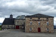
My next landmark was the Glenmorangie distillery. In the days when my Mum and Dad used to run a pub, Glenmorangie was always one of my Dad’s favourite drinks. He had passed away a number of years ago but visiting the distillery felt like a respectful pilgrimage in his memory. Aside from a couple of shiny new extensions, the place had the look of somewhere that hadn’t changed much in decades. Predictably, I didn’t sign up for the tour (busy man, places to go etc. etc.) but taking a few photos and buying a miniature was enough for me.

Back on the trail, there was meant to be a shortcut that took you through some woods rather than taking you towards Tain. Through a combination of bad navigating and missed/missing waymarkers, I ended up missing the shortcut and heading to Tain anyway. I’m sure it will become a theme for this trek but when you are tired and you are already doing a lot of miles, you really don’t want to do any unnecessary miles on top of that.

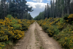
For the rest of the day the route took me along a mixture of forest access roads and more country lanes with barely another person to be seen anywhere. It was all pleasant enough even if I wasn’t in the best mindset to fully appreciate it. At one point, the trail does a little detour so that you don’t have to walk on the road. The only snag being that the detour takes you along an actively forested track complete with fallen trees and mini reservoirs (okay, big puddles) where the water had pooled in the dips in the road. As I could feel my feet getting wetter and wetter, It’s fair to say there were more than a few outbursts of swearing.

It became clear I wasn’t going to make it as far as Alness and so started to keep my eyes open for somewhere to camp. All the fields seemed to have animals in them or at least not offer much in terms of anywhere hidden from the road. I bumped into a couple of women chatting outside their houses and asked them if they knew anywhere where I could pitch a tent (if I am honest, half hoping a garden might be offered). One of them suggested a spot further up the road next to a water reservoir. Sure enough, there was a small patch of grass, admittedly not bowling green flat, with a handy little gorse bush that almost hid you from the road. It would do. God I was tired. It had been a long day. One final nightcap to raise a toast. Cheers Dad.

Day 8. Balnaguisich to Inverness

John o’ Groats Trail Day 8.
Distance today: 33.2 miles.
Total distance: 170.1 miles.
Accommodation: hostel.

It has to be a bad sign when you’ve just started out on the road and you are already feeling tired. I had a sense that I was in for another long day. Was this going to be the final day of the John o’ Groats Trail? I tried to do the maths and I think Inverness was at least 25 miles away. Ho hum. Looking on the positive side of things, it was still early enough to have the road pretty much to myself, I was surrounded by pleasant countryside, and up above me there was a beautiful sky.

I arrived in Alness hoping to find a café. Nothing. The next stop was Evanton and it didn’t look like there was much there either. I did manage to get a local to fill up my water bladders so that was a good start. Luckily there was also a co-op where I could stock up on essentials which at that time consisted of bread and peanuts. The bottles of Innocent juice caught my eye and it was nice to drink something sugary sweet for a change.

Eventually made it to the Cromarty Bridge – my third long, wind-swept close encounter with fast moving traffic in 3 days. The cars definitely don’t like to hang about up here. Safely on the other side there was then an unfriendly hill to climb to get to Culbokie. Sadly, it was here where things started to go a bit wrong.

Detour 1: I almost walked a full circle trying to find my way beyond Culbokie. As much as I would like to blame bad signage, there was almost certainly some incompetence thrown into the mix.

Detour 2: There are some woods before you reach Munlochy, and the trail waymarkers happily lead you into these woods. What they don’t do is lead you out. Suddenly you are faced with 3 or 4 directions you can go in with no clues as to which is the right one. God I was angry.

Detour 3: This might not have been a detour but it felt like a detour. Beyond Munlochy, the trail steers you towards Munlochy Bay. You follow the coast for a while before leaving the mud flats behind and heading inland in a seemingly zigzagging route, never entirely confident you are going the right way. Road junctions in particular seemed to be lacking reassuring waymarkers. Eventually after a reasonable amount of uphill you end up in another big wood. On the whole, the scenery was nice. Nice enough to justify the convoluted trail? Not so sure. Again tiredness was almost certainly kicking in and clouding my judgement.

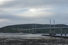
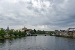
Finally, I caught sight of both Inverness and the Kessock Bridge leading to it. That was a good moment. I was nearly there. Made my way down to the bridge and after crossing it, I played chicken with the traffic to cross the 4 lanes of dual carriageway to get to the steps leading down from the bridge run-off. Bizarrely, the route seemed to thread its way through industrial estates and business parks before it reached the slightly more picturesque River Ness. From there, you followed the river until you arrived at the city centre.

I’d forgotten that it was Saturday night and after 8 days spent largely on my own, it was very strange to see big crowds of people out on the beers. Even more so because I was quietly making my way through the mayhem, in full backpacker gear, dutifully following the little black and white “Southbound John o’ Groats trail” signs. I think the trail ended somewhere near the castle but annoyingly the castle was blocked off for construction work. A bit of an anti-climax. After a quick google, I discovered there was a way to get to the other end of the castle and it was there I found a big stone marking the start of the Great Glen Way. I think that also marked the end of the John o’ Groats trail but it wasn’t particularly obvious that it did. As I said, a bit of an anti-climax but I touched the stone to at least commemorate my version of reaching the end of the trail. Ta-dah!

It might seem an odd way of looking at it but one of the reasons why I saw Inverness as an important milestone was not only because it was the end of the first trail but also because it was a good transport hub to get to if something happened and I had to quit the trek and restart it again later. It was like I was already planning for failure. Ever the optimist.

My next task was to find the Inverness Youth Hostel. I’d booked ahead and reserved a room for 2 nights. As a final confirmation of my poor navigation skills, I got lost again. I’m really not sure I am cut out for this challenge. When I eventually found it and was walking in, there were 2 American guys sat at one of the outside tables with a huge half-finished takeaway feast in front of them. “Are you hungry?”, they asked. As it happens. Once I’d checked in and grabbed a beer, I joined them and gleefully tucked into an array of fast food delights, courtesy of a local Chinese restaurant. My American hosts were from North Carolina, over here cycling through various parts of Scotland. After saying cheerio to them I headed to my room, had a long shower and then just crashed. 33 miles walked today. I think that’s a new personal record.
Day 9. Day off

Accommodation: hostel.

As I didn’t have much I desperately needed to do (other than not walking 20+ miles), I allowed myself the luxury of a very lazy start. One job I couldn’t avoid was hand-washing most of my stinking clothes. My “private room” was actually a re-purposed dorm with me as the only occupant. What it lacked in charm, it made up for in the number of places I could drape my newly-washed clothes as well as having the space to empty the contents of my ruck-sack prior to a “re-sort”.

Eventually drifted into town in the early afternoon. Of the 3 main things I had on my shopping list, I was successful tracking down some more packets of dehydrated food and a Harvey map for the Great Glen Way but sadly no luck with the lamb Sunday roast. I had a real craving but none of the pubs could oblige so I settled for chicken instead. That was pretty much my day.
Day 10. Inverness to Drumnadrochit

Great Glen Way Day 1.
Distance today: 22.1 miles.
Total distance: 192.2 miles.
Accommodation: campsite.

Another day, another trail. I’d liked to say I was fully rested after my day off but for some reason I didn’t sleep brilliantly. Rather than fight it, I decided I may as well get up and as a consequence, I was down at the start of the Great Glen Way by 7.00.

The John o’ Groats trail had been a real baptism of fire. 170 odd miles of ups and downs (metaphorical and literal) over 8 days. I’d ended most days knackered, with a variety of aches and pains but always with a sense of “getting there” bit by bit and, dare I say it, of achievement. If only that I’d made it another day without my body completely falling apart. The trail may still be a bit rough ‘n’ ready but it rewarded you with some stunning scenery that felt all the more special because you had to make an effort to get to see it. I had met barely a handful of hikers – never mind thru hikers – in the whole 8 days. By contrast, the Great Glen Way was meant to be much more …. tame. We shall see.

The route out of Inverness takes you along the river and across the Ness Islands which are 2 wooded islands in the middle of the river, linked by bridges. It’s all pleasant enough in a municipal park kind of way. From here you pass through a mish mash of suburban dog walking territory – parks, housing developments, scrub land, and even a small stretch of canal. After a long gradual climb, you eventually get to the point where you are officially in the countryside.

To be honest, I found the first stretch of mainly forested trail a bit dull. Eventually it opened out on to what looked like moorland – or at least land where there used to be a forest – and that was better if for no other reason than being less claustrophobic. At some point I was joined by a day hiker doing the same section of the trail. He was a softly spoken Scottish guy who was probably a few years older than me and we chatted and walked together for while before it became clear I was going too slow for him. Not longer after, he sped away and I was left to contemplate that I had been overtaken for the first time on the trek.

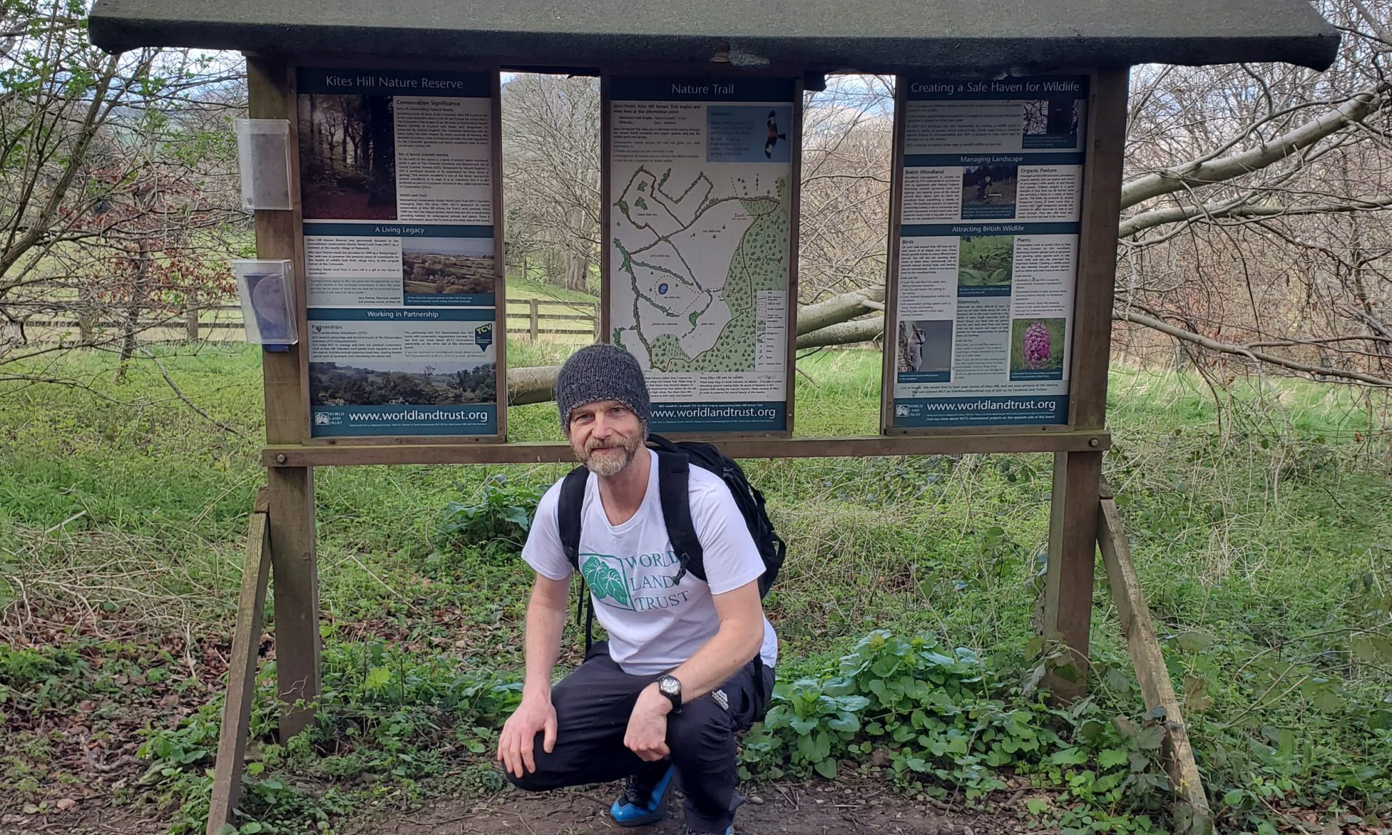
Sometime around 11.30 I was walking through a bit more woodland and I noticed a few hand-painted signs promising coffee and cake up ahead. The writing on the signs looked almost child-like which didn’t bode well for my hopes of a Barista quality flat white but I was still intrigued enough to go check it out. The Abriachan Eco-Campsite & Café was certainly not your average café. It’s eco credentials were evident in the ramshackle but commendably recycled nature of all the buildings which were going for that beach shack vibe. I really did just fancy coffee and cake but somehow I was persuaded to upgrade to the light lunch. This, apparently, was much more appropriate for someone like myself who was doing an epic challenge and therefore needed feeding up. And so I was. 5 minutes later I was presented with a tray full of a bowl of soup, strawberries in some sort of juice (with a small piece of chocolate), cheese and biscuits and tomatoes plus a big wedge of lemon cake plus an entire cafetiere full of coffee. This was way too much. As quirky as the place was and however much I admired their ethos, I couldn’t help feeling railroaded. And it made me wonder how many other people had been led down the same path. Oh well. I was suitably refueled and even obliged the owner by allowing my photo to be taken so that my Facebook mugshot could be added to the thousands of others. I did quite like his caption: “Ordinary Man doing Extraordinary Journey” in a self-congratulatory kind of a way.

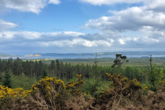
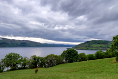
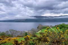
Back on the trail, the landscape continued to swap between forest and moorland until I was finally getting towards Drumnadrochit when Loch Ness came into view to add a bit more interest.

Drum, as those in the know like to call it, appeared to be the epicentre for all things Loch Ness and Loch Ness Monster. Every other business was Loch Ness something. Including my campsite: Loch Ness Bay Camping which was situated a bit further out of town. After stocking up with provisions at the co-op, I headed to the campsite which, on first appearances, looked reassuringly spacious. I had to smile at the fact that mobile homes outnumbered tents by about 10 to 1.

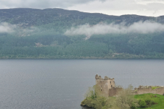
Once I’d pitched my tent, I headed out for a wander – just to stretch my legs. Urquhart Castle was only 15 minutes away and it seemed rude not to visit it while I was in the neighbourhood. All the post cards I’d seen of it made it look mysterious and ancient. Sadly, the presence of a new-looking jetty and equally new-looking pathways did their best to spoil any sense of romance. It’s a shame because it was an amazing setting. Maybe you just had to imagine what it would have looked like without the modern trappings. In any case, I’d arrived too late for admission and was consequently limited in the angles I could find to take a decent photo. And believe me, I tried.

Back at the campsite, I finally got round to having the big wedge of lemon cake.